Goshta District (Gōshtah)
Goshta District is located in the northeast of Nangarhar Province, Afghanistan and borders Durand Line between Afghanistan and Pakistan. The district's population is Pashtun and was estimated at 160,000 in 2002, of whom 30,000 were children under 12. The district is within the heartland of the Mohmand tribe of Pashtuns. The district centre is the village of Goshta, on the Kabul River.
The Goshta district is located on the Durand Line between Afghanistan and the Khyber Pakhtunkhwa province of Pakistan. From the highlands that define the border, dry hilly country with seasonal streams slopes down to the flat land along the north side of the Kunar river valley where most of the people live, at an elevation of about 540 m. Average temperatures in the valley range from 3o in January to 27o in July. Precipitation is low, perhaps 150mm per year, mostly falling in the spring.
Agriculture is the main source of income. Crops include wheat, corn, sugar cane and rice. At times, opium poppies have been an important crop. Goshta's residents do not have a modern water supply system for their crops. They traditionally drain water from the Kunar river, which flows along the south of the district, using hand pumps and shallow wells. Floods often destroy valuable fields. In the hill country, water must often be carried long distances by pack animal. Most villagers do not have access to potable water.
Map - Goshta District (Gōshtah)
Map
Country - Afghanistan
 |
 |
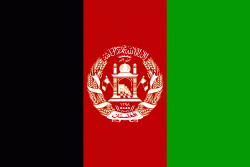
| Flag of Afghanistan | |
Human habitation in Afghanistan dates back to the Middle Paleolithic era, and the country's strategic location along the historic Silk Road has led it to being described, picturesquely, as the ‘roundabout of the ancient world’. Popularly referred to as the graveyard of empires, the land has historically been home to various peoples and has witnessed numerous military campaigns, including those by the Persians, Alexander the Great, the Maurya Empire, Arab Muslims, the Mongols, the British, the Soviet Union, and most recently by a US-led coalition. Afghanistan also served as the source from which the Greco-Bactrians and the Mughals, amongst others, rose to form major empires. The various conquests and periods in both the Iranian and Indian cultural spheres made the area a center for Zoroastrianism, Buddhism, Hinduism, and later Islam throughout history.
Currency / Language
| ISO | Currency | Symbol | Significant figures |
|---|---|---|---|
| AFN | Afghan afghani | Ø‹ | 2 |
| ISO | Language |
|---|---|
| PS | Pashto language |
| FA | Persian language |
| TK | Turkmen language |
| UZ | Uzbek language |


